Second week of the trip (26.7.-1.8.)
Monday:
Light rain came down from the cloudy sky the whole night. At some point of the morning I woke up and rain had stopped. I did not had any idea of the time and I did not care, this is holiday. My body demanded some morning coffee which I made while other campers were still sleeping.


After tent was packed on top of the bike I stopped to the nearby gas station to fill the tank and my stomache. This time breakfast consisted only another cup of coffee.
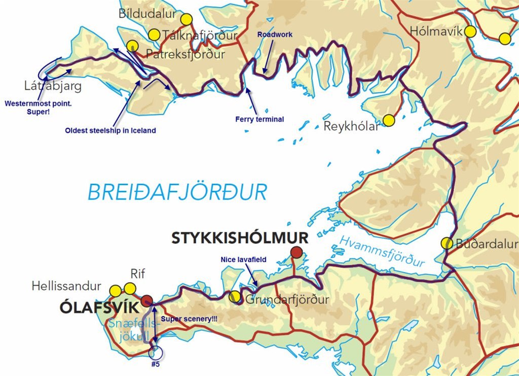
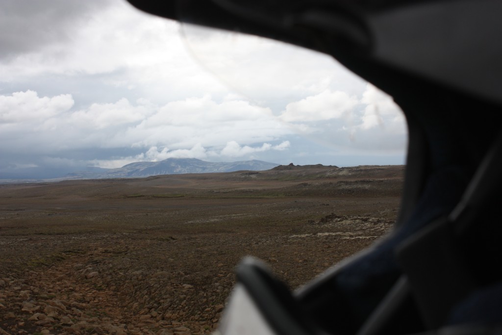
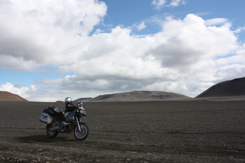
Luckily weather had dried and blue sky was visible. I decided to head towards to westernmost point of Iceland and europe, Bjargtangar. After Patreksfjördur I had to ride a bit paved road before it turned to a good condition gravel road. On my way towards Bjargtangar I met a couple (arrived on a same ferry as I) and asked the condition of the road ahead. Comment was "ok road" with a wide smile :)
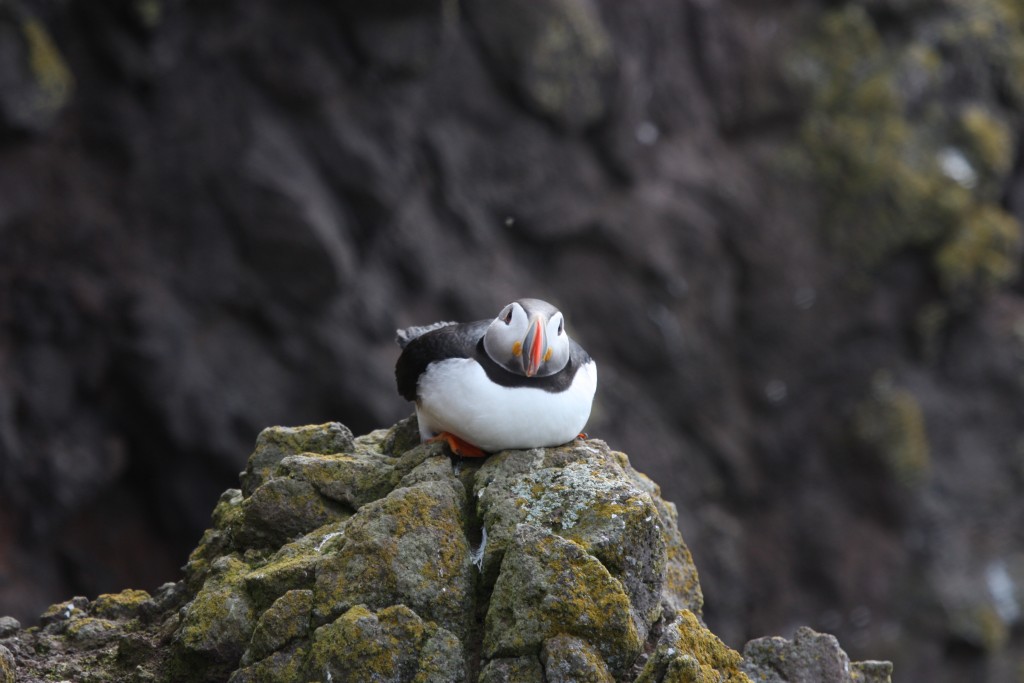
After around 50km of riding I achieved westernmost point. Several cars were already parked to the parking area and people seemed to shoot photos at the edge of the cliff.
I had to check how does the world look like at the tip of the peninsula :) Looked the same as everywhere else :) I think I shot few hundred photos in this area from the scenery and puffins. Puffins were funny looking birds which let the photographers to come really close.
I also saw a sign post which said that this is the westernmost point of Iceland and europe. Greenland is only 300km away to the west.


I had really an unreal feeling due to the possibility to visit this place. Last Christmas I visited westernmost- and southernmost points of continental europe... Where should I go next?
While I was riding towards east I started to feel pressure inside my helmet. Reason for this was ridiculously wide smile :) I was also thinking that tedious ride in the previous day was worth it. Better way to see this westernmost point and Dynjandi waterfall is to come here on a ferry from Stykkisholmur. This way you save time, nerves and you could avoid long road construction which starts around 10km after the ferry terminal (to the east).
While I was riding towards ferry terminal, I stopped to take a photo of the Island´s oldest steel ship.


While still riding gravel road I passed motorcycle couple which I met earlier during the day. Seemed like riding a gravel road was quite tought for both of them. Riding looked really stiff and speed was really slow (woman had Tenere and man had R80GS, so gravel should not be a problem).
At the ticket counter in Brjanslaekur I tried to understand their timetable. Finally I deciphered this timetable and noticed that there is only two ferries each day! Next departure would be hours away, so I decided not to wait.
Around 10 km from the ferryterminal started 20km long road construction. Partly this construction area was build with quite big boulders, so I needed to be really carefull not to damage tyres, rims and myself... Finally construction area ended and I was able to gain some kms. Actually I think southside fjords are more beautifull compared to the northside. Scenery was also better compared to the previous day.
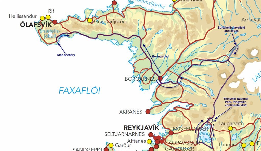
Road between Westfjords and Budardalur is long and quite boring. After turning to Snaefellsnes peninsula towards Olafsvik scenery started to change. Scenery reminded me again how Iceland has formed millions of years ago.


While chewing excellent late breakfast in Olafsburg (time was around 18-19:00) I noticed my ears had started beeping (due to ride without earplugs). I did not find my earplugs in the morning, so I decided to ride without them... Not such a wise decision.
I asked from the girls behind the counter if glacier road is in ridible condition. Only answer I got from them was "it is open"...
After the excellent breakfast I headed towards the Snaefellsjökull glacier which was growing bigger in front of me. Road was actually in good condition (I would still recommend to have 4WD car or motorcycle, even you could be able to drive this road with standard car).
Scenery close to the glacier/volcano was breathtakingly amazing! Black ash, bluish glacier, green moss etc. Photos below do not give any justice for this scenery... If you are in Iceland, you need to visit this place!
I climbed up to a dormant volcano to grab couple rocks for a souvenier (cordinates N64° 48' 57.8" W23° 43' 31.5")


I would have missed this area if fellow Italian rider would not had recommended it.
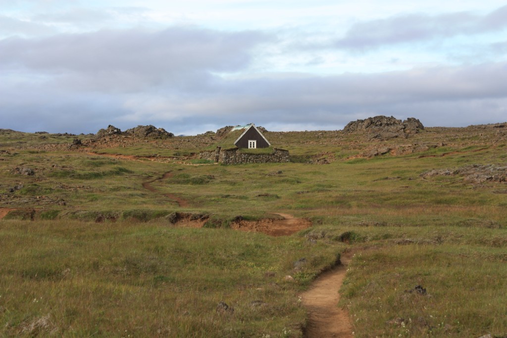
Arnarstapi camping ground was located south from glacier in a nice area where ancient lavaflow had strechted to the sea. Camping ground had nice reception with restaurant, so this time I would also get good breakfast. Due to nice surroundings in the camping ground, I thought I would also enjoy nice warm shower tonight. Later in the evening I noticed that there is no shower in this camping ground. Only hot water in the whole camping ground was boiling in my pot while I cooked evening coffee...
After a day ride this track was in my GPS:
Some thoughts about the day that had passed today:
- I am worried about the wear of my rear tyre. Luckily I can get new tyre from Reykjavik if needed.
- Day was excellent! Visiting westernmost point was magnificent experience (much better than I had imagined)
- Visiting glacier and dormant volcano in this amazing area was one of the top moments of the trip so far.
- Where should I go tomorrow? Dark clouds in the south and also few water drops came down in camping area.
Tuesday:
In the morning I felt really lazy, so I slept as long as I could. After getting up I went for a short walk to the nice steep shore.
After tasty breakfast, standard morning routines and towards east and dark clouds (packing the bike starts to be routine and all the gears have founded their place in the bags). Shoreline was nice but after turning a bit more to the inland towards Borgarnes I started to get bored... Nothing special to see at this part of the road (road #54).
From Borgarnes I headed towards Surtshellir cave (I found this from the map in the previous evening). To my surprise this longest cave in Iceland is located in amazingly long lava flow (lava flow is 52km long). I followed this lava flow and couple times I was quite sure I was lost, but finally I found parking area in the middle of nowhere. I spent some time walking around and shooting some photos from the cave openings. Noticeable was absolute silence here, I did not hear even birds...


Next target was one of the most famous and most historical places in Iceland, Thingvellir (another link) national park. Road #550 was in quite "shaky" condition, full of washboard. Thingvellir area has really long history in the governance of Iceland. Laws have been announced here and parliamentary proceedings started here already 930AD all the way to 1798AD. Thengvellir is also part of Unesco World heritage list. From nature perspective, you can see here continental drift between North American and Eurasian plates.
I decided to camp overnight in here. Camping ground also had shower! Excellent!!!
First thing was to put up a tent and take of sidebags from the bike, then I headed towads parliament area.
After taking a lot of photos I decided to go around the Pingvallavatn-lake to see also surroundings around this area.


I could not behave while riding around the lake on a gravel roads... I really enjoyd sliding the backwheel while coming out of the corners. Spinned the rear tyre everywhere and screamed inside my helmet from the absolute pleasure for being able to enjoy my life this way... Shame on me, but it was damn fun and I would do it again and again and again :)
Warm shower fealt heavenly after several days of sweating. I did not care even some people were banging to the shower room door, let them wait while I enjoy the shower :)
After the shower I prepared Chili con carne for dinner. For some reason beans did not want to get soft so finally I gave up and ate hard beans while studying the map.
Notes from the diary:
- Highlight of the day was definitely warm shower!
- Lava field was stunningly large.
- Thinvellir was a bit disappointment. I guess I expected something more dramatic (mayby something like Grand Canyon) view in the area where continents are drifting apart. I would recommend to familiarize yourself to this area before coming here so you could get more out of it.
- Neighbours are having such a loud party that one camper moved further away.
Wednesday:
In the evening I decided that Wednesday would be rest day because ride to the Reykjavik would be only 60km.
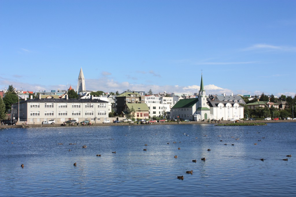
After the light breakfast in the camping ground reception I pointed front wheel towards Reykjavik (visitreykjavik, reykjavik.is). While I was riding around Reykjavik and tried to find a hotel, I was quite surprised how widely spread this city is (actually several towns melted together).
Finding a suitable hotel was easy and also price was lower than I had expected. From the reception I tried to get infomation of local laundry facilities. One laundry facility was close, but they did not have same day service, so I decided to wash my clothes in bathroom sink. After washing I just hoped that all clothes would be dry in the morning... Room was looking quite a mess when wet clothes were hanging all around the room :)
Weather in Reykjavik was excellent, sunny and warm. I walked around the city looking sights, drinking coffee and visited one museum (Reykjavik 871 +/-2 museum). I missed couple other museums because they closed already at 17:00...


Visiting Reykjavik was also a milestone in my life, for the first time in my life I actually payed for haircut... I had to tell several times to the barber "cut more, more, even more, it will not get too short" :)
Notes from the diary:
- Buildings in Reykjavik are only few storeys high
- Pedestrian area in downtown is full of shops for tourists... Surprise ;)
- Service in the city is not as polite as elsewhere in Iceland
Thursday:
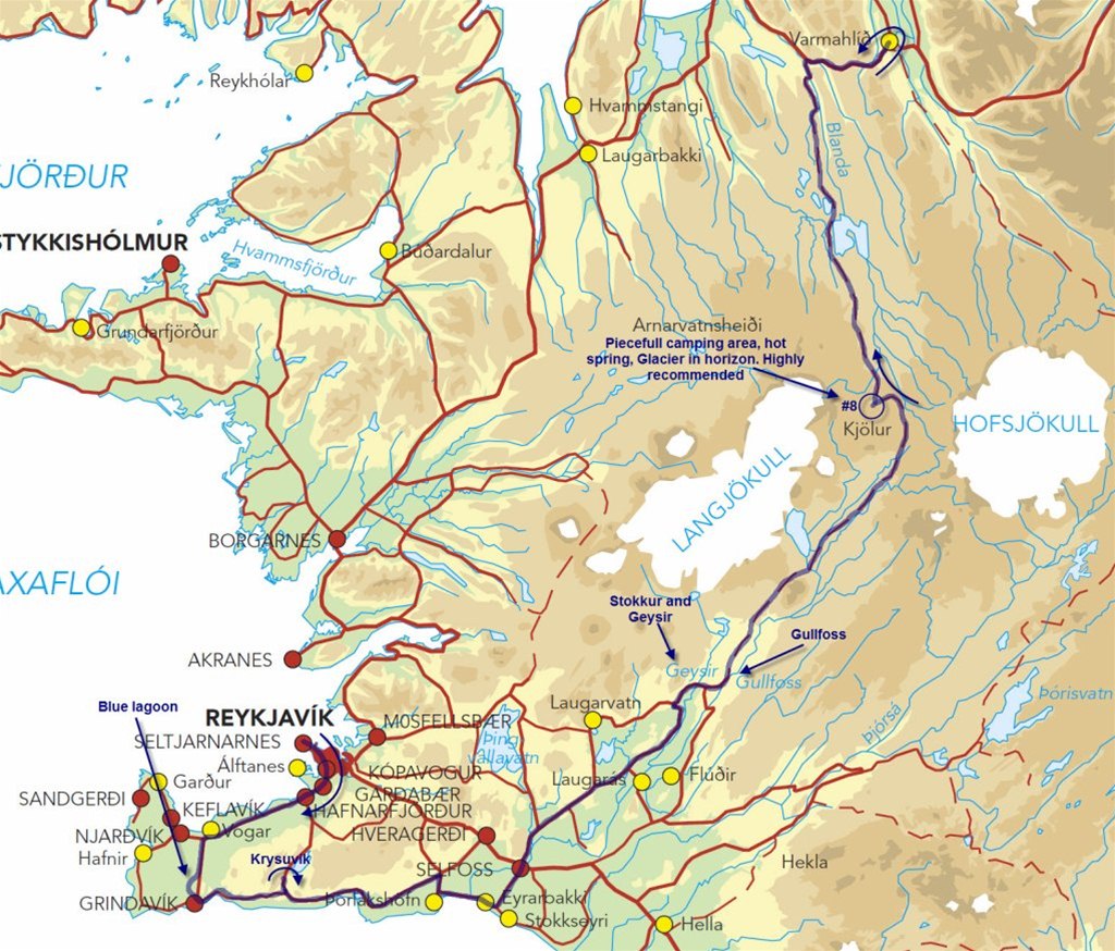
In the morning under the threat of rain I headed towards one of the most famous sight in Iceland, Bluelagoon (wikipedia). Bluelagoon is roughly 40km towards southwest from Reykjavik. Road there is straight and boring.
Water for Bluelagoon is coming from the nearby geothermal station, which pumps it from 2000m below the surface!
Sky was covered with clouds and small drizzle was coming down when I stopped next to Bluelagoon to take few photos. I did not visit Bluelagoon spa, but needed to take couple photos.

Next I followed road #427 towards Krysuvik active area. Drizzle turned to a light rain when I arrived to Krysuvik. On a short visit to this site I saw some bubbling mudholes and noticed a fine scent of sulfur. I think Namafjall in the north was looking more exotic. If weather would have been better I would have spent a bit more time here and maybe I would have seen something more "dramatic".
My stomache started to scream some food, so next stop was in Selfoss grill. While I was enjoying tasty Icelandic hotdog, few trucks passed me. According to the commercials on the side of the trucks, they were heading towards formula offroad race. Unfortunately I did not know where this race was taking place, it would have been really interesting to see these "hard core" racing machines taming Icelandic landscape.
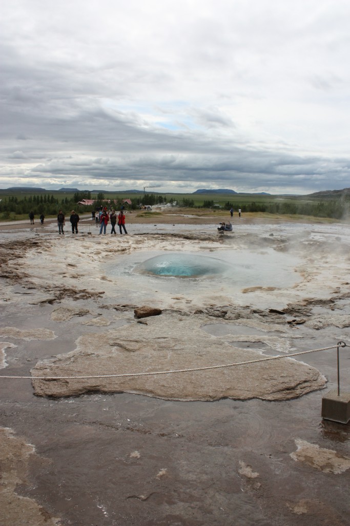
My next plan was to check Geysir, but due to poor weather I decided to check it on Friday. Nowadays all erupting fountains are called geysirs, but original Geysir is in Haukadulur, Iceland.
After refueling I continued towards northeast. Luckily light rain stopped, so I decided to grap some photos from Gullfoss waterfall. Waterfall was ok, but still clearly most memorable waterfall was Dettifoss. On a parking area I had nice discussion with one fellow Italian rider. He was on a seven week trip, plan was still to go to Norway and possibly also Nordkapp (he had visited Nordkapp already five times before). Hopefully I can have similar seven week ride someday...


Already at home I had decided to spend one night in the next camping ground. From Gullfoss I rode to northeast via road #35. Camping ground is located in Hveravellir (NAT) between two glaciers Langjökull (second largest glacier in Iceland) and Hofsjökull (third largest glacier in Iceland). Road #35 was in quite good condition (you can get here with normal car). Every now and then there was short streches of washboard and stony sections but nothing that you cannot drive with standard car.
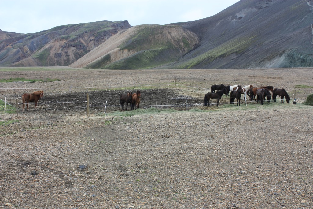
While riding I suddenly noticed long line of horses close to the road. Little after this encounter I stopped for a hot coffee at one lonely cabin. I mentioned horses to the guy who was hosting this small cabin. He said that this group had spent previous night at this cabin and next group was going to arrive after few hours. He also mentioned that biggest groups have around 100 horses and they can do even one week long trips through the island.
At early afternoon I arrived to the camping ground, so I quickly had a cup of coffee and then I continued towards north. Road surface was much better starting from camping ground. Actually road surface was in too good shape because it was quite hard to obey speed limit, 80km/h (even bike was wobbling quite heavily every now and then).


After the gravel road I had to ride a bit paved road before arriving to Varmahlid. Here I filled my stomache and also fuel tank. Here I also changed batteries to Spot Messenger for the first time. Surprisingly long time these batteries had lasted. After everything here was done, I followed my tracks back to the camping ground, cold beer after a nice day and then I put up my tent.
Later in the evening I enjoyed couple hours in the nature´s hot bath, just listening absolute silence and admiring big glacier in the horizon... This place really felt like paradise!
Few notes from the diary:
- Some time it is quite hard to keep consentration to the road surface while scenery around is this amazing. I lost consentration couple of times and immediately I felt this in my hands (got couple hard hits to the front rim from the rocks).
- Camping ground has quite many French people
- Now holiday feeling really starts to kick in!
- First amazing week is now behind. This island has much more to offer than I dared to expect before the trip. What will 2nd week bring?
Friday:
This morning wake-up call was different... I did not woke for the warmth of morning sun, instead I woke up sounds of sheep heard next to my tent :)
I walked around the area and shoot some photos. For breakfast I ate some strange yoghurt-like stuff which did not taste like yoghurt, but still filled my stomache.


Today my ride was taking me towards south. After leaving the camping area I took it really easily and slowly. I was thinking that maybe in the previous day I rode too fast because I got several hard hits to the front tyre...
I stopped few times to take some photos of the nice open area and a glacier in nearby.
I passed 3 or 4 couples who were going through the island with their bicycles! These guys are in a real adventure! Have to really admire these really really tough guys... It is so much more easier to ride motorcycle.


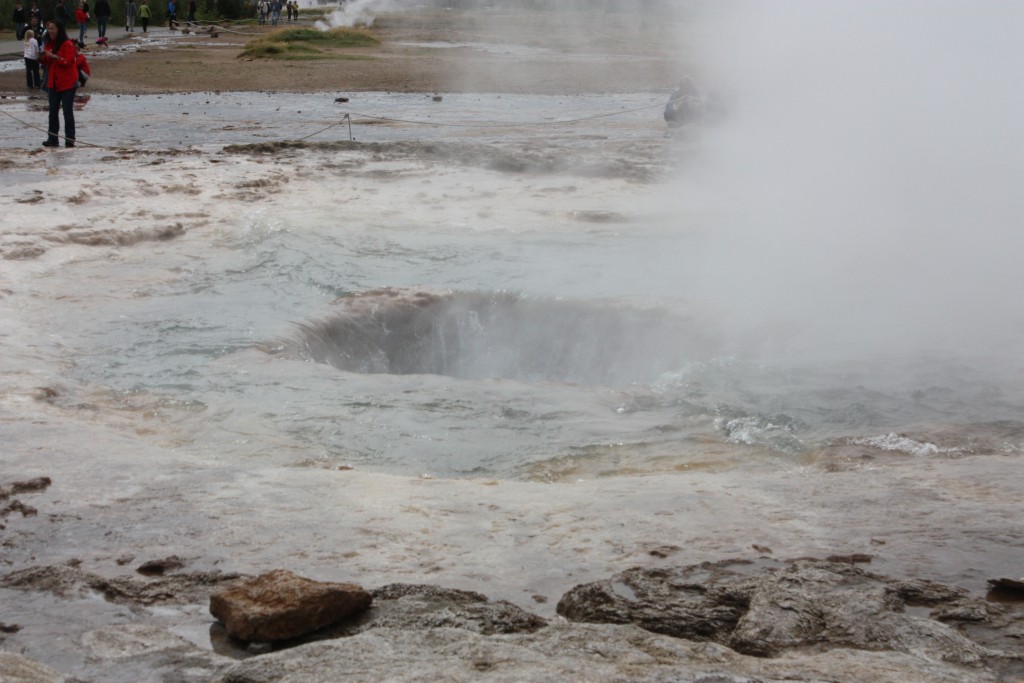
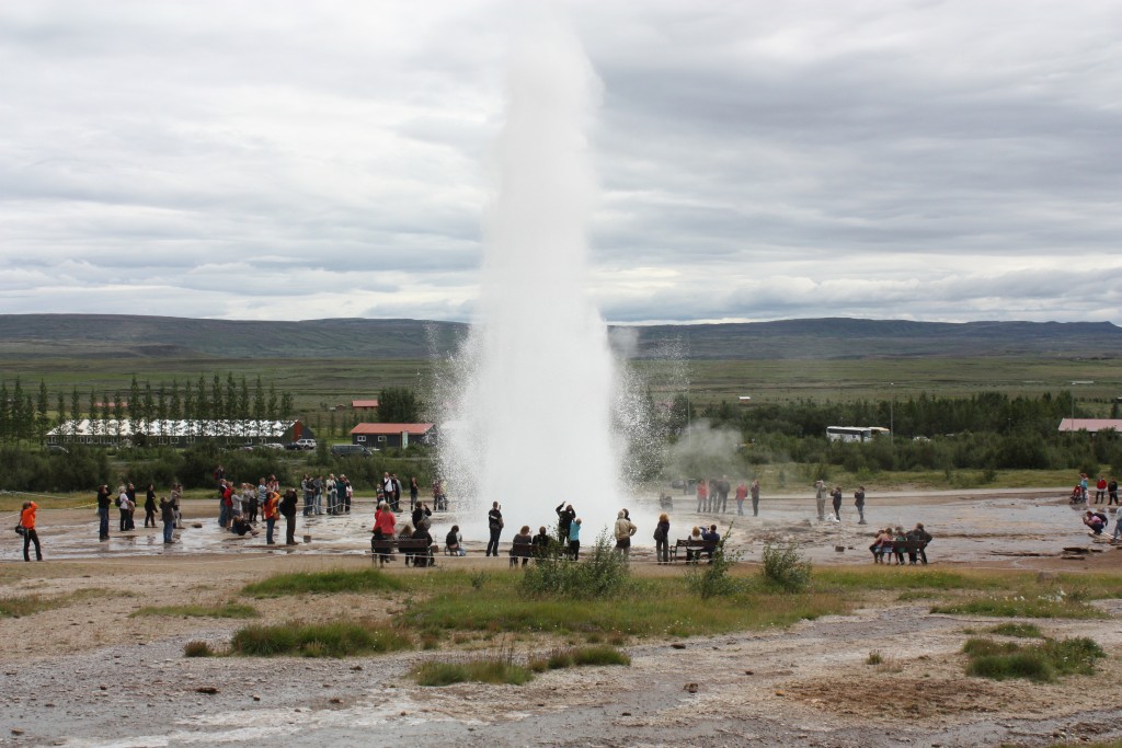
While going towards south, I stopped to shoot some photos and video from Stokkur. Stokkur erupts every 5-8 minutes. Quite many people are coming here from Reykjavik by bus.


After taking these photos, I filled gas tank and had quick lunch.
My map showed last refuelling station before heading to inland would be in Fludir, so I stopped there to top-up bike´s tank. In reality there was still two gas stations after Fludir. Last refuelling station can be identified from the sign which said "next gas station 240km".
While heading towards east, I had a plan to visit Haifos waterfall (this is Iceland´s second highest waterfall, 122m). Unfortunately I did not find trail leading to this waterfall.
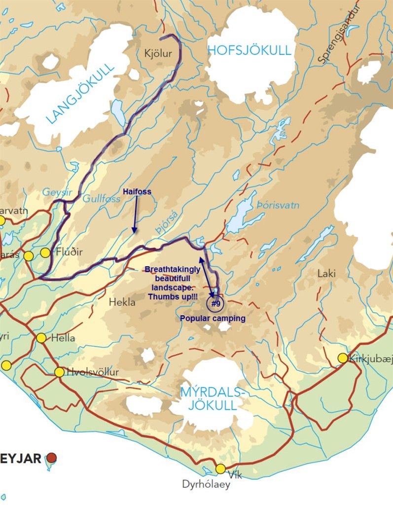
While riding towards east I was thinking if I should continue towards north on a road #26 or should I camp in nearby landmannalaugar camping site. Couple locals highly recommended this camping site, so I decided to spend night there and ride road #26 on Saturday if weather would be ok.
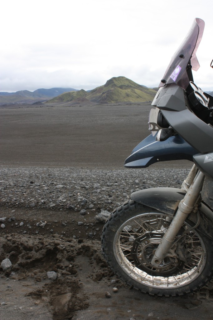
Road #208 was paved all the way to the powerplant, after this, road surface varied between gravel, stones and ash.
Sceneary totally surprised me again... I had not seen such a view anywhere else during this trip. I had to stop constantly to shoot some photos (once again, photos do not show the real picture of this area). If you are in Iceland, this area is one of the "must-see" places. 

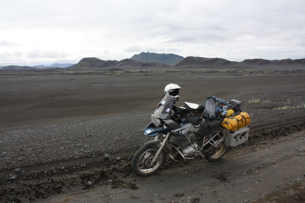


I had to cross couple knee-deep calm rivers before entering to the camping area. Luckily one guy on the opposite site was guiding me where to cross.
Camping area was already quite packed. I found free spot next to French KTM rider. While I was pitching my tent, one German guy told me that this camping area is really popular among hikers and in some times only way to camp here is to make reservation beforehand.
During the evening I heard that sceneary at half an hour walk from camping site would be much better for what I had seen this day. It must be truly amazing if it would be better than this day...
I had planned to visit hot pool during the evening, but it was over crowded all the time so I spent my evening reading a book. At some point I woke up for my own snoring, closed book and continued sleeping.
Saturday:
First thing what I heard in the morning was rain drops dancing on the roof of my tent -> more sleep. After a bit more sleep, rain had stopped so it was my time to make morning coffee.
French rider was already up. He said he had slept really badly due to party in the nearby tents. Hmmm, I have not heard anything... Must have slept like a baby :)
While I was enjoying my tasty morning coffee I made decision to head towards north via #F26.
Just before the starting day´s ride, I had coffee with one German guy who said hikingtracks here are absolutely amazing. Started thinking that this could be good location to stay few days longer.
This time I got through camping area river crossings almost dry feet. I went a bit further away from the main crossing area and this time used also more speed.
I was really happy for spending time in the previous day to shoot all the photos. At the moment this magnificent sceneary was totally covered by fog.
Paved road continued all the way to the point where road changed from #26 to #F26. After this point road surface changed from paved to really loose gravel and deep washboard. While I was sliding and bouncing around I was thinking few times if this road is really worth of all this punishment and if I should really give up and turn back... For some reason I always decided to continue a bit further and check how this road looks like after next corner.


First turning point (where I really wondered if I should turn back) was at the point when first river crossing was in front of me. I sat on a small rock, eating chocolate bar while wondering if I should cross it or if I should turn back. Water was crystal clear and current was really weak. I thought that if I would now turn back, then for sure at some point it would start bothering me... So, only real option was to start the engine and cross this river. Actually it went really easily.
After this, road turned a bit narrower and at the same time washboards almost completely disappeared. Now riding started to feel really good again (after miserable morning) and in next few river crossings I even did not wet my shoes at all.
Last bigger river crossing was so close to my target that I crossed it with a smile on my face.
Final turning point came right after camping ground (Czech Humwee drivers mentioned this camping ground one week earlier). In front of me was quite wide river with strong looking current. I decided that I will not even try to walk over this river because I would need to cross it again when coming back the same way. I was quite happy that I missed only 5km from this road (between two rivers). So, next I returned to the nearby camping ground and made lunch and coffee.
While preparing my lunch I had chat with the guy who takes care of this camping ground. He mentioned that water is quite low at the moment. He also mentioned that in the same location few days earlier one Italian GS rider had tried to cross the river. He was not so lucky and dropped his bike in the middle of the rapids. Bike was totally under the water.... Needless to say that I was even more happier for my decision to turn back :)
Ride back to south went much more easier and more smoothly than ride to north. I rode almost complete distance to the pavement by standing on footpegs. Speed was constantly between 80-100km/h. River crossings did not cause any problems because I remembered where I had crossed them earlier. Washboard did not felt bad even bike was feeling like raging bull :)
While riding towards south I was wondering why riding felt so easy... Final conclusion was that luch gave some extra energy to put more focus to the riding. I also thought that higher speed caused suspension to work more efficiently. In any case, riding really was a pleasure again.
Gravel road on #26 was was really fast, wide and dusty. Cars who passed me from the opposite direction did not bother to slow down at all, result was shower of small stones (luckily I had installed headlight protector). Riding was such a pleasure that I did not stop even on a second gas station but just kept ongoing (mainly because fuel gauge showed that I still had fuel left)
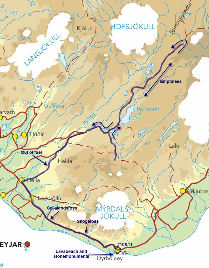
On a road #271 it finally happened... Engine died because I ran out of fuel... I tilted bike to both sides and after this engine started just to die again after few kilometers. According to map, next fuel station was roughly 10km away in town called Hella. I continued my ride by tilting bike, riding, tilting, riding etc... During this 10km ride, engine died 6 or 7 times, but luckily I got almost all the way to the gas station (it finally died around 20m away from the station). I was able to put 20,14l fuel to the tank, so it looks like there was still 3l of fuel hiding somewhere in the tank.
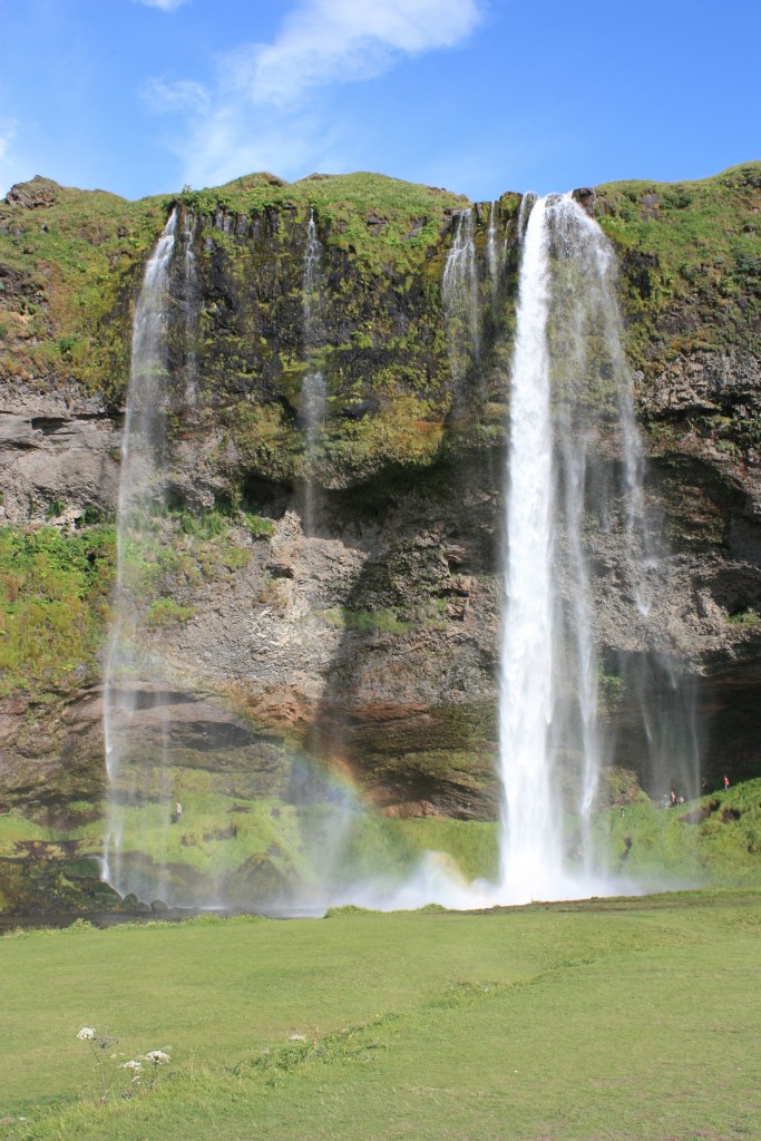
My next stop was at Seljalandsfoss. This was nice small waterfall, which you can go around from the backside. After few photos I continued to the next waterfall, Skogafoss which was also nice. My opinion is that both of these waterfalls are nicer than Gullfoss, but not as nice as waterfalls in the north.


Now I was on the southside of the Iceland so next camping was in a small town called Viki. I was planning to stay in this area for one or two days, just relaxing. Viki camping ground is in a nice place and best thing is that it has also shower!
At one point in the evening clouds started to flow over the nearby hills making sceanary look unrealistic.


Notes from the diary:
- I really have to slow down or otherwice I might have a problem with rear tyre.
- I need to slow down also due to next service in my bike is going to be overdue around 1000km after the trip (so I really have to skip some plans).
- Bike needs a bit oil
- Air filter need to be cleaned tomorrow
- What a great day today!
Sunday:
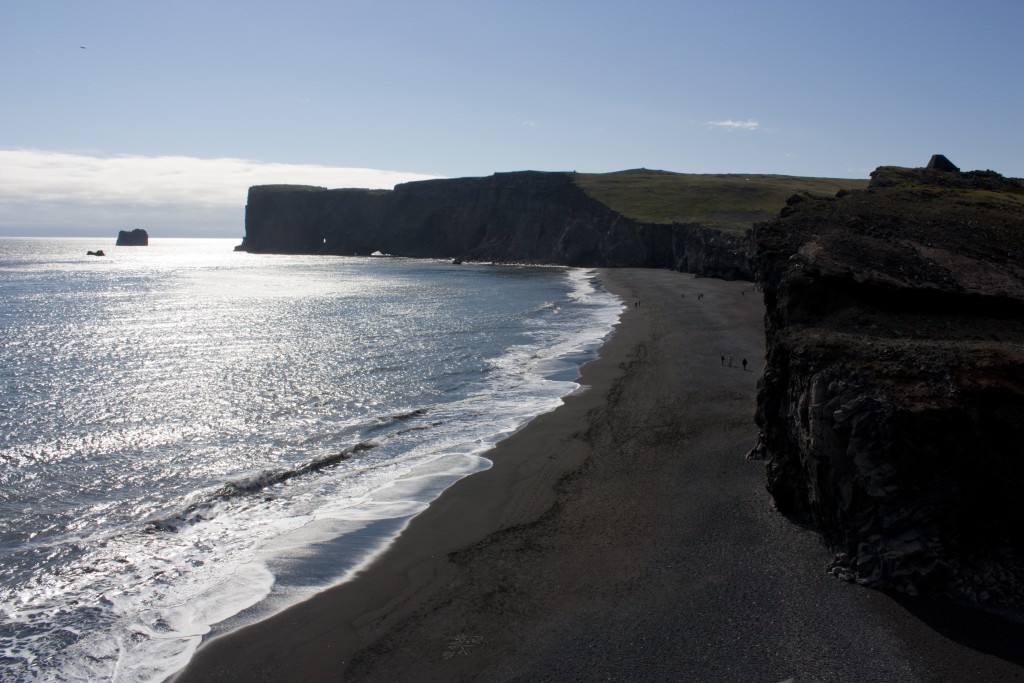
This morning I just slep, slept and slept a bit more. Plan for today was just relax, read book and do some small service for the bike. After service was done, I rode to the nearby black lava beach, saw Dyrholaey and enjoyed tasty Icelandic pizza for early dinner.


![]()
After I got back to the camp, I took afternoon nap which actually continued all the way to the late evening.
Notes from the diary:
- My boots are still wet (Sealskinz have kept my feet dry)
- Do I have fresh air poisoning or why do I sleep so well here :)
- Rear tyre looks quite bad
- Tomorrow will be a short day again.